Preprint on satellite-based crop field inventories in smallholder landscapes
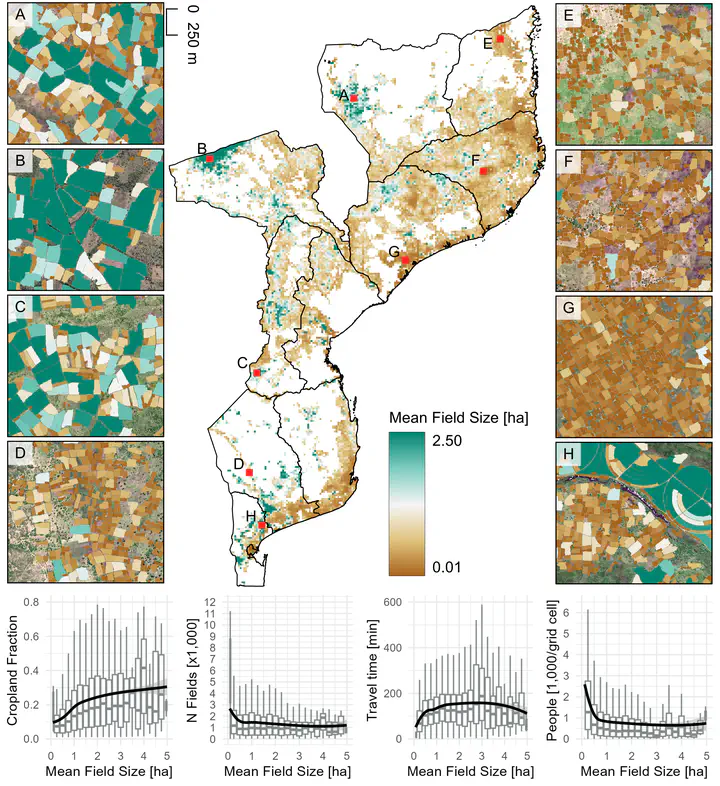
We mapped ~21 million individual fields across Mozambique, allowing unique insights into the spatial distribution of agriculture, field size and linkages between agriculture and forest cover change.
Smallholder farms are strongholds of global food production and provide livelihoods to rural populations across the globe. Surprisingly, fundamental properties of smallholder systems remain only weakly understood, which hampers the design of sustainability-centered policies and aid interventions. We here present an approach to delineate individual agricultural fields from very-high resolution satellite imagery (1.5) at the national level for Mozambique (covering ~800,000 km²). The workflow has minimum reference data requirements and is highly transferable across regions, providing a stepping-stone for better understanding smallholder farming systems. We derive detailed field boundaries for 21 million fields, allowing unique insights into the spatial distribution of agriculture, field size and linkages between agriculture and forest cover change. Our results show that field size is a key indicator relating to socio-economic and environmental outcomes of agriculture (e.g., food production, livelihoods, deforestation, biodiversity), as well as their trade-offs.
Read the full preprint here!